Christmas Island
Why visit Christmas Island
Christmas Island is an Australian external territory in the Indian Ocean, much closer to Java than to the Australian mainland. It is the summit of a submarine mountain, with a limestone plateau, steep sea cliffs and rainforest descending towards small bays and the settlement at Flying Fish Cove. Much of the island is protected as national park, and its isolation has produced wildlife and ecological relationships found nowhere else. The annual movement of red crabs from forest to coast is its best-known spectacle, but the island’s multicultural community and dramatic underwater drop-offs are equally important parts of its identity.
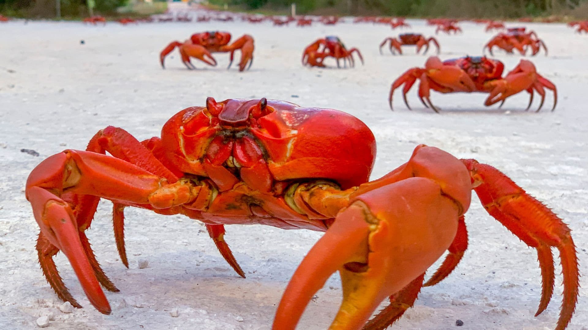
Rainforest walks lead to viewpoints, blowholes, secluded coves and places where robber crabs and endemic birds can be observed with care. During the red crab migration, tens of millions of crabs move towards the sea in response to rain, moon and tide, and roads and purpose-built crossings are managed around them. Offshore, the reef falls sharply into deep ocean, creating wall diving and snorkelling sites where clear water, coral, reef fish, rays and seasonal large marine life may be encountered. Flying Fish Cove also brings everyday island life, swimming and sunsets together within a short distance of the visitor centre.
Phosphate mining drew workers from China, Malaya and elsewhere in Asia under British colonial administration, creating communities whose descendants continue to shape the island’s languages, food, temples, mosque, festivals and neighbourhoods. The island was occupied by Japanese forces during the Second World War and later administered through Singapore before sovereignty transferred to Australia in 1958. This layered history is visible in industrial remains, cemeteries, religious sites and settlement patterns. It should be understood alongside the island’s living Chinese, Malay, Australian and other identities, not treated merely as background to its wildlife.
Passenger flights connect Christmas Island with the Australian mainland and the Cocos (Keeling) Islands, while the port also receives authorised vessels. A hire car is the practical way to reach dispersed walks and coastal sites, although migration closures, weather and park conditions can change access. Accommodation and dining are concentrated around the settled north-east, with fewer choices than a mainland resort region, so planning ahead is sensible. The tropical wet season influences seas, tracks and the crab migration, while the drier months generally suit broader exploration. The visitor centre and Parks Australia information should guide current access without embedding volatile schedules in a general introduction.


© Christmas Island Tourism
Experiences in Christmas Island
WānaTravel partners with Viator and GetYourGuide so you can browse and book experiences directly. Prefer a personal touch? Contact WānaTravel and we'll add it to your itinerary for you.
WānaTravel partners with Viator and GetYourGuide so you can browse and book experiences directly. Prefer a personal touch? Contact WānaTravel and we'll add it to your itinerary for you.
Practical Information
Travel essentials, government safety advisories and The Out Index score for Christmas Island.

Out Score of Christmas Island
Out Score of Christmas Island
64
Tier B