Sint Eustatius
Why visit Sint Eustatius
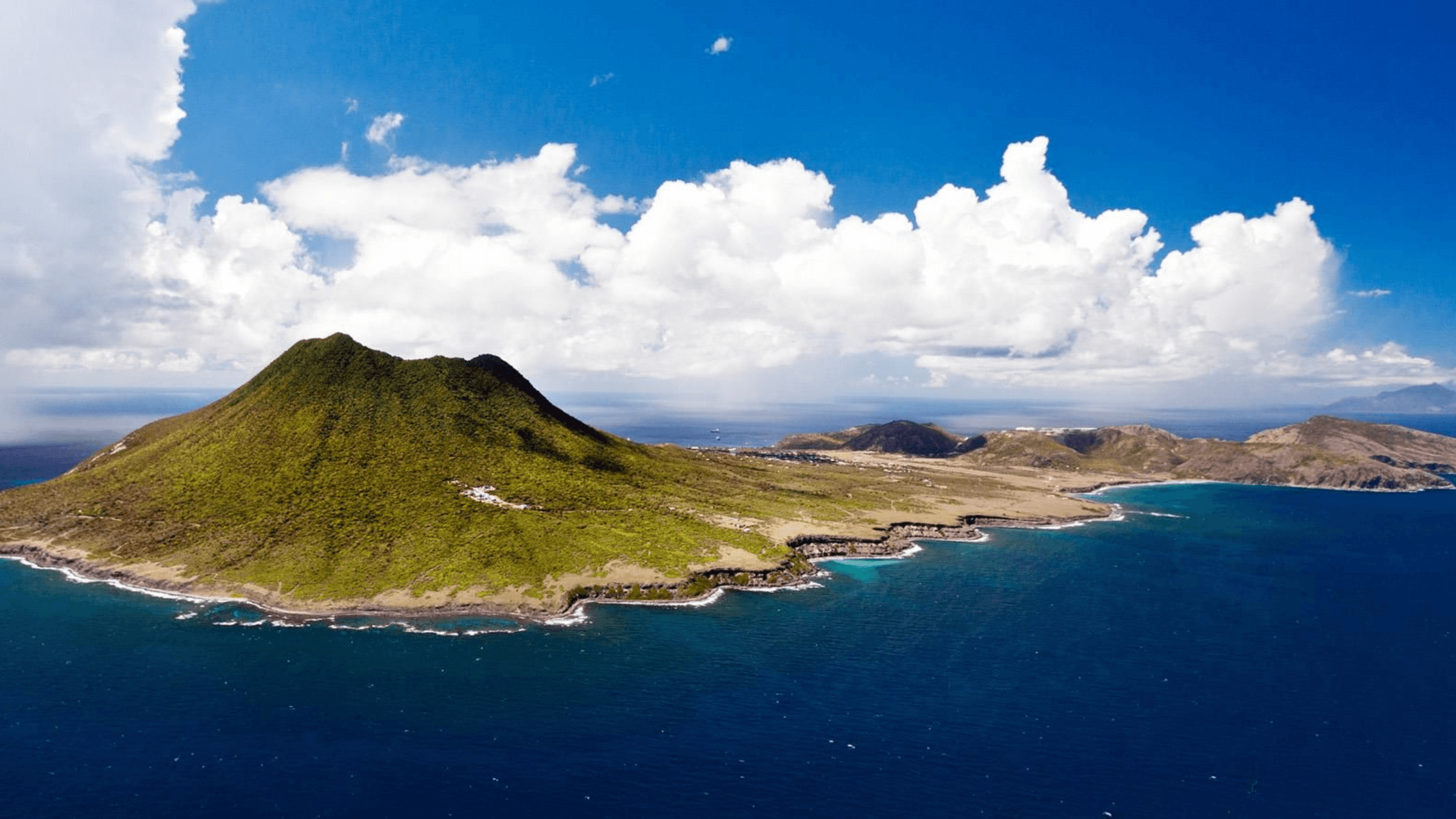
Sint Eustatius, often called Statia, is a special municipality of the Netherlands in the northern Leeward Islands. The island rises from a narrow coastal plain to the Quill volcano, with Oranjestad and the historic Lower Town facing the sea. Its small scale brings together volcanic slopes, black-sand beaches, dry hills and important archaeological and marine sites.
Fort Oranje overlooks the harbour, while the ruins and warehouses of Lower Town connect the shoreline to the island’s eighteenth-century trading history. The Quill and surrounding national parks provide hiking through tropical vegetation, and the marine park protects reefs, wrecks and coastal habitat. Snorkelling, diving, walking and exploring the old town form the core of most visits.
Statia’s culture was shaped by Indigenous Caribbean histories, European colonisation, African diasporic communities, plantation and trade economies, and the island’s later role within the Netherlands. Dutch and English are used in public and community life. Museums, forts, churches, archaeological sites and local stories show both the wealth created by trade and the human cost of slavery and colonial rule.
F. D. Roosevelt Airport provides regional air access, with sea connections also used when available. Roads link Oranjestad, the lower town and the interior, but services and accommodation are small in scale. Visitors should allow time for weather-sensitive connections and arrange guided heritage or nature activities where needed, particularly when exploring the volcano, coastal ruins and protected waters.
Experiences in Sint Eustatius
WānaTravel partners with Viator and GetYourGuide so you can browse and book experiences directly. Prefer a personal touch? Contact WānaTravel and we'll add it to your itinerary for you.
Practical Information
Travel essentials, government safety advisories and The Out Index score for Sint Eustatius.

Out Score of Sint Eustatius
Out Score of Sint Eustatius
68
Tier B